Day two started quite well…the second time.
I…may…have mistakenly left my 0600 alarm active, which I…thought…I had turned off the morning before.
Well, no sense looking to lay blame, right? (Damn phone!)
Anyway, a good morning for a nice cup of coffee and cooking breakfast over the campfire.
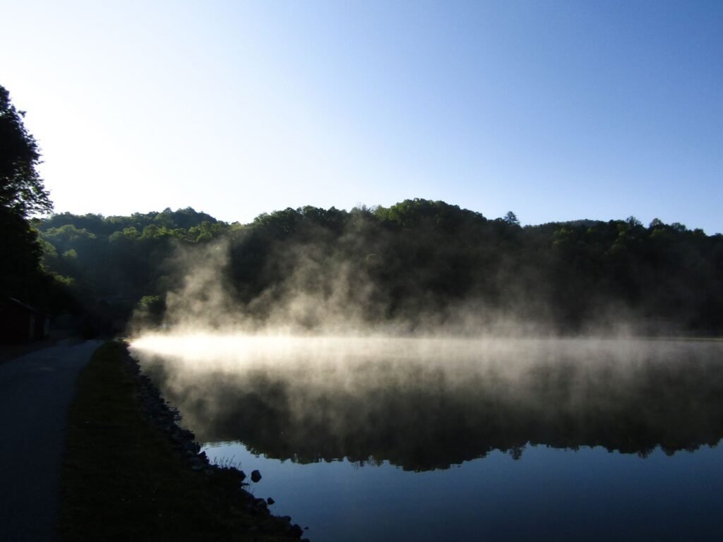
One of the things I had hoped for on this trip was colorful sunrises and/or sunsets. It’s something generally missing the the Houston area and being back around mountains made me hopeful for rippling colors painted across the skies…
(Insert wavering effect then a visual reminiscence of PNW sunrise, here)
Yeah…no. No such luck.
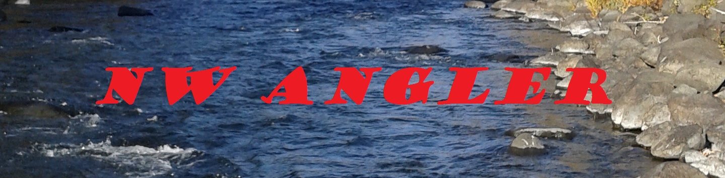
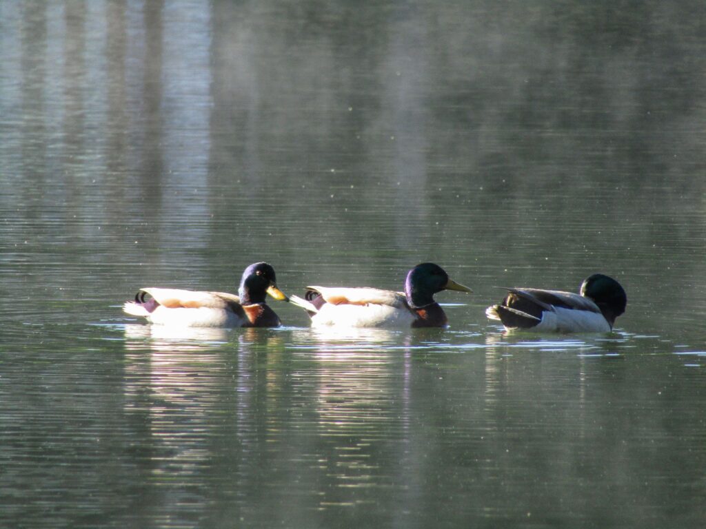
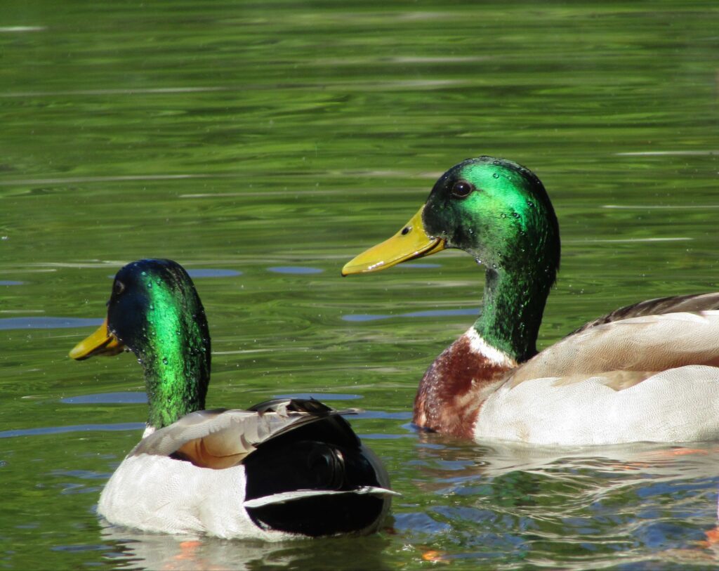
But, crips morning air, a misty pond, and some quietly paddling waterfowl for company can go a long way…
It was a day where we had plans for right around noon…followed by other plans in the afternoon, but, of course, that meant a bit of freedom in the morning.
And, what does one do, with open time like that, in well-wooded mountains?
EXPLORE!
If one were to drive out of Hiawassee, GA (34°56’52.54″N 83°45’23.17″W), heading roughly south on US 76, you would find yourself in some absolutely beautiful country. Rolling hills give way to the tapering ends of mountain spurs, and the woods gather along the sides of the pavement as if the crowded trees all wanted to meet you in person.
Eventually, you will come to a sign on the right that announces the “High Shoals Scenic Area,” at about 34°49’31.58″N 83°43’59.36″W. A bit farther and you see the way leading off to the left, with a small FS sign identifying it as Road 823.
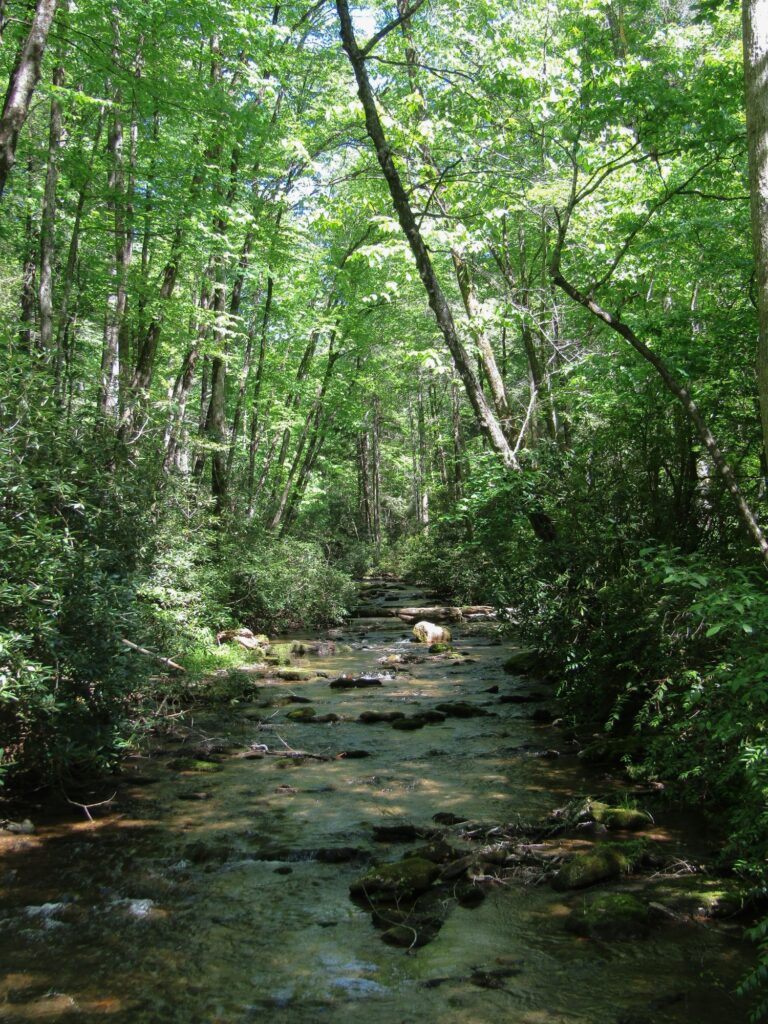
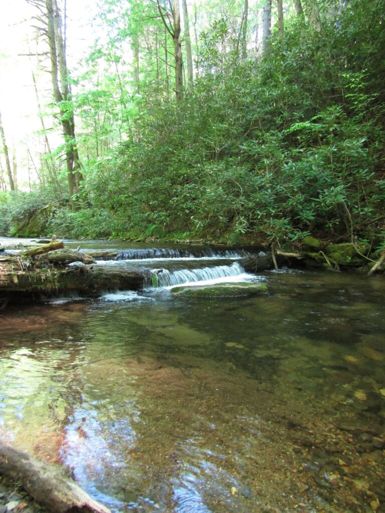
I had seen reference to a waterfall that could be found in that area, and was looking forward to some pics (and maybe finding a great spot to later fish). A short distance down that road, however, you come to this spot…
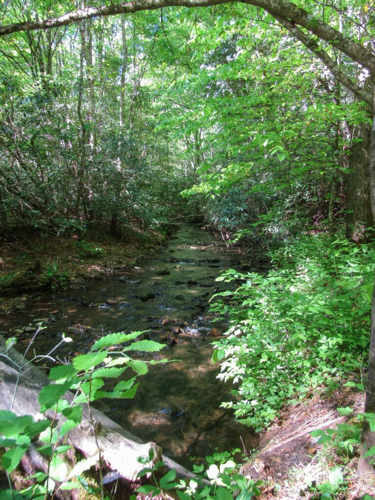
That’s stepping out of the car and looking upstream, to the right. What a great, little creek!
To the left…
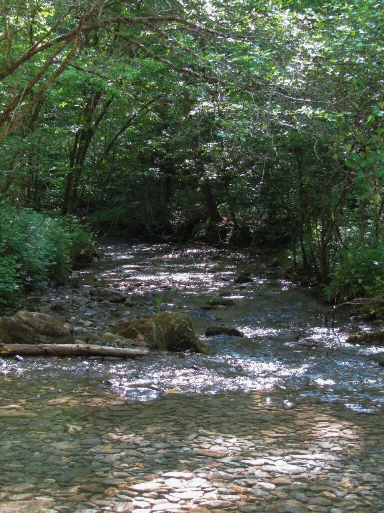
Great water. Arching trees, which would probably allow space enough for roll casting or perhaps some horizontal casting…
The challenge, however, in terms of that goal of finding a waterfall to photograph, is the foreground.
Those who have waded such crisp, clear, inviting streams know right away how deceptive the depth can be. For this trip, we brought the sedan, as we were not hauling the travel trailer. Half the gas consumption is great, given the cost of fuel, these days.
The clearance of a sedan, when fording a low spot in a creek, however…?
Still. Mental note made, both as a possible fishing spot and for future trips (with more clearance).
Hopping back on US76, and continuing generally southward, we climbed for some time, passed a pull-off parking spot that was marked as a trailhead (later found to be a spot on the Appalachian Trail!), then a FS road on the right, with a pair of plain-ish signs (at 34°47’59.77″N 83°44’36.12″W).
“Chattahoochee Wildlife Management Area”
Okay, I’m listening.
“Mark Trail Wilderness”
Now, I don’t know anything about that “Mark,” but I do like a good trail and love wilderness. It seemed (relatively) smooth, so we gave it a try.
Like all good FS roads, it wound about, gaining altitude while clinging to undulating the side of a mountain, and kept almost giving us breathtaking views of a valley off to the left. Almost, I say, as the forest was tight around us, blocking the clear view but lacked the background depth to keep it from being lit by that green glow of sun-warmed leaves in the canopy.
Some distance up, just before another left-hand swing of the road, the glisten of water caught our attention.
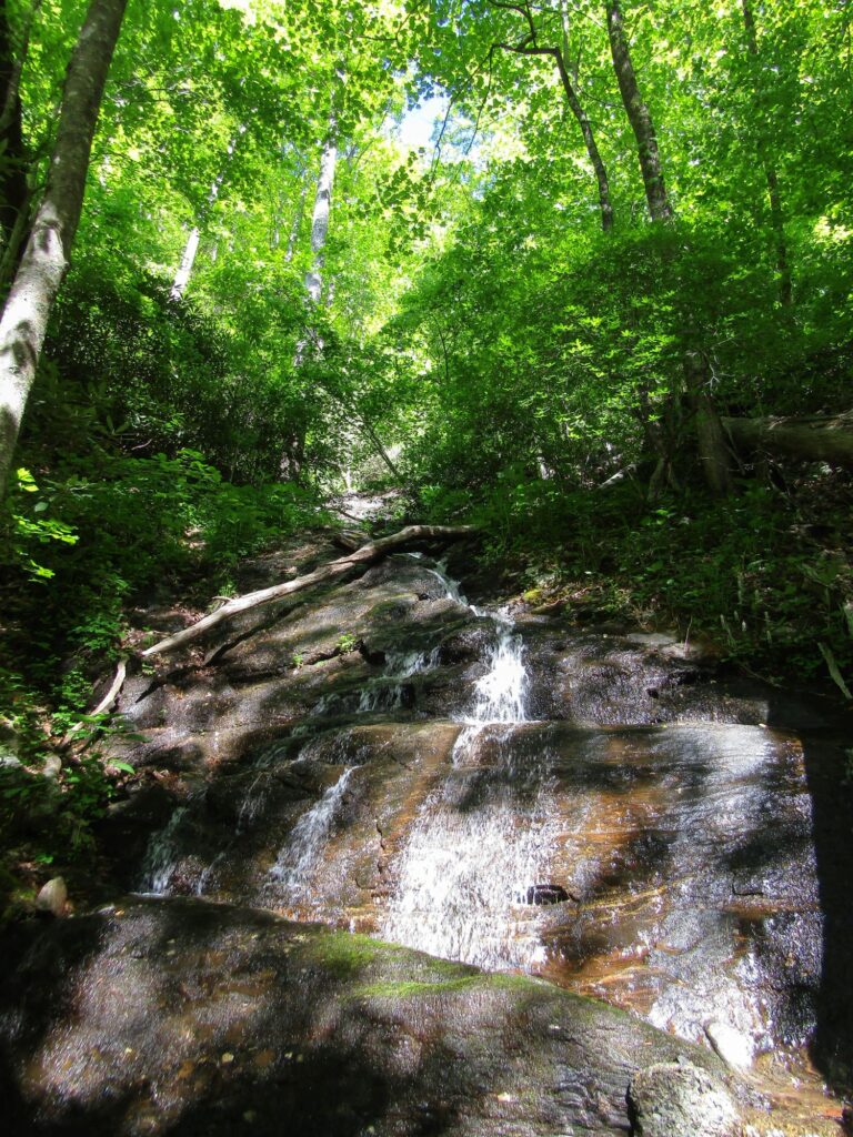
So peaceful and relaxing…
As we continued, we passed multiple dispersed camping spots, only one of which was in use.
Again, the mental notes were amended for potential, future use.
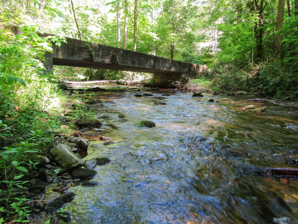
Finally, the road ends up at the Upper Chattahoochee River Campground area (34°47’13.09″N 83°46’58.41″W). The road we had followed was blocked by a locked swing arm, just before a bridge that linked to the continuation of the way.
Disappointing to not continue on the path we had started…but…I do like bridges in the woods, so I grabbed the camera and took a look.
If we didn’t have plans for Noon…
In the process of looking around there, I also realized that the area I thought was a picnic spot and turnaround, actually had a side road leading off to the left (as one pulled into this area).
Following this, we crossed a different bridge, where the creek passed from right to left, under us.
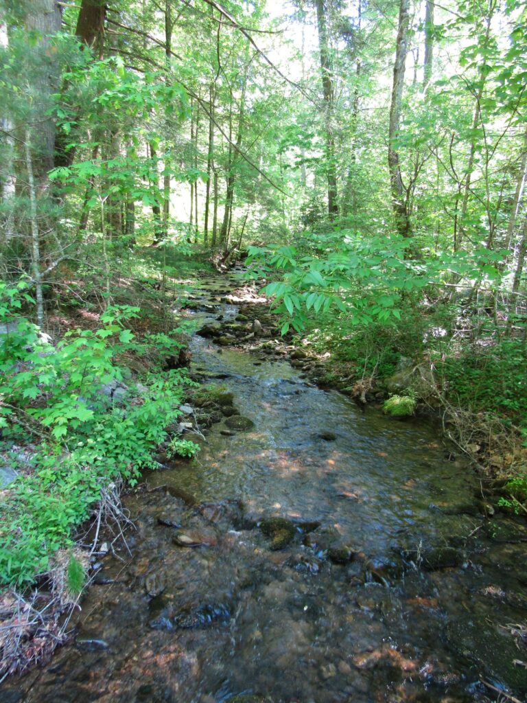
Then found a spot to pull off, the creek enticingly splashing at our side, and a beaten trail leading down the gentle slope next to us.
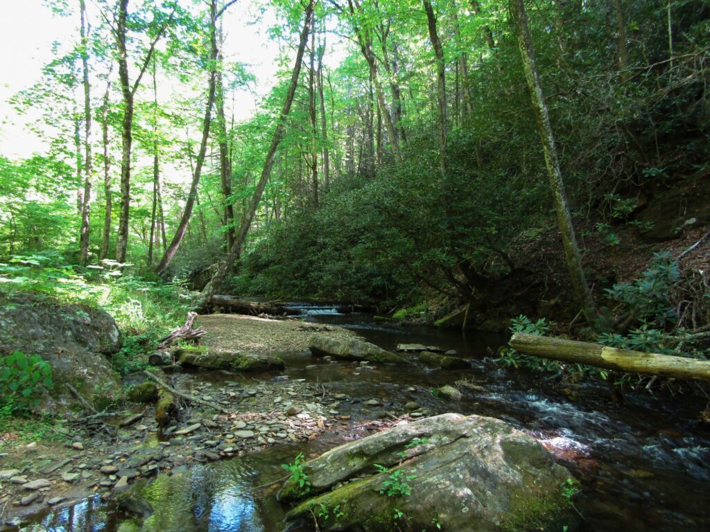
The path seemed to draw me to that downstream spot, but the feeling that came over me when I turned and looked upstream made me wonder if that was just to make me see the view from this angle, at first glance.
If only this didn’t have a “Day Use Only” sign, that spot would make for an excellent tent location. You know, that place, right there. Oh, let me show you.
True, I would not want to be there when a sudden storm blew in, pounding the valley walls with soaking rain. I mean, the smooth rocky patch is smooth for a reason, after all, but what an amazing location…
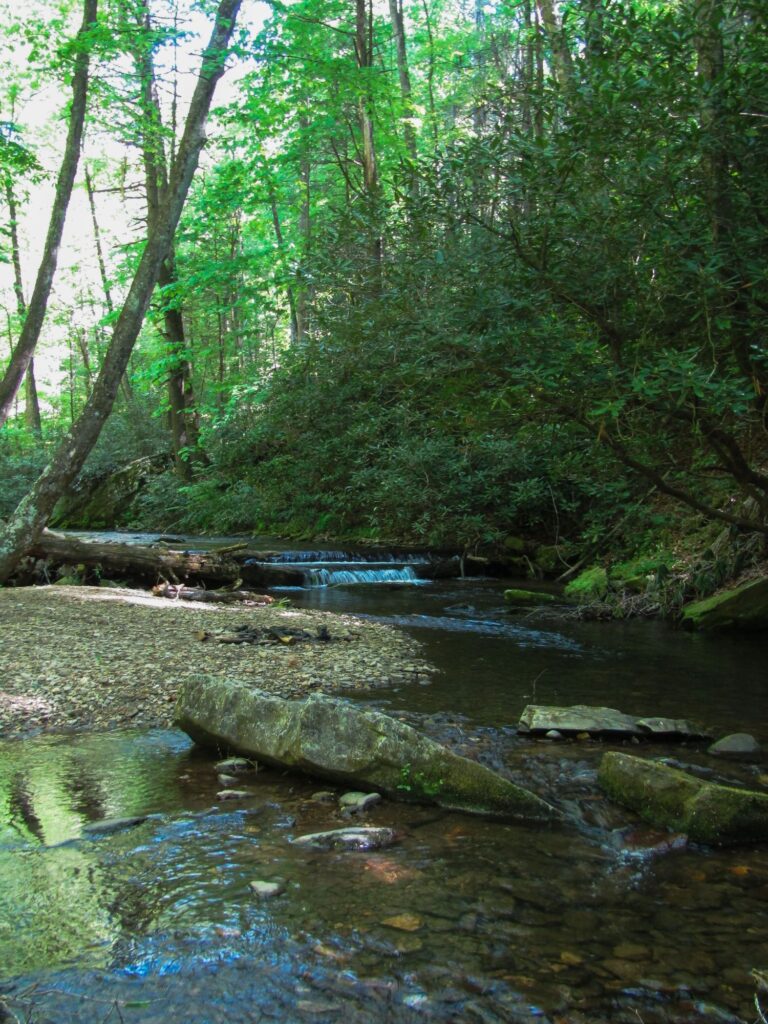
Yes, those two layers are fallen trees, laying across the path of the stream. Obviously, no idea how long they will remain there, but what a great pool below them!
Checking the time, we turned and started the return journey. Family at noon, back at the cabin.
I found, checking maps a bit more closely, later, that this area is very close to the headwaters of the Chattahoochee, which I had heard was an excellent trout destination, in the right sections. It had me wondering what those waters might hold.
When we made it to the cabin, I set to work building a reasonable campfire.
Just as that reached a reasonable temp, and the deep, familiar smell of the wood smoke had played fond memories of other trips in my mind for a while, my SIL arrived with her husband and two of the four kids for a larger gathering, hot dogs and S’mores available for any takers.
She had kindly brought quite a bit of other food to add to the options, as well. Conversations kicked off and her youngest made some casts with his spinning rig in the pond (which you will see more of, later), as the afternoon rolled on.
At some point, though, suggestions were made as to where I might do some fly fishing.
Okay, I like helpful people.
Then printed maps were offered.
Umm…why are there buildings shown on the same map as places to allegedly fly fish?
Then the discussion turned to where “others” might have had luck with worms and dough balls, in the past.
So, why is your mouth still open and producing sounds, again?
All well-intended, to be sure, but just not what I look for. Don’t get me wrong. It’s great to see and spend time with family…but, well, being family doesn’t necessarily mean sharing in the same outlook on things, does it?
Er, umm, thanks.
After a bit, it was time to say goodbye for the day, and get showered and changed for the trip down to the Atlanta area and the afternoon reunion that had been planned.
We arrived just after 4pm, at the home of A.L., a great friend of mine since High School, some [NUMBER REDACTED] years ago! He and I, and some of the old crew, had kept in touch via texts and occasional calls, but this was the first time we had actually gotten together since he had moved down south, not too long after graduation, and the path of my life had bounced me all over.
That bottle of Grandaddy Mimm’s was delivered, upon arrival, perhaps as a sort of apology for how overdue that day truly was.
Both of us married (both of us “married up,” too!), so it was a chance for our wives to put faces and voices to the stories they’d heard…and to hear new ones, too!
Always great to reconnect with good friends, spend some time, break bread together, and perhaps a glass or two of adult beverages. A.L. made an excellent Low Country Boil for us all, and a great time was had! For A.L. and I, it was like not time had passed, at all. I think our wives even had a good time, despite our odd banter.
(A.L. – you and S.L. are always welcome in our home, brother!)
No, as has always been my policy, no names and no faces will be shared, but memories will be retained!
2+ hours back, and off to bed. Day 3 looked like there would be one morning item planned, a good gap, then one more item in the evening, but that gap would fit some time spent in flowing waters very nicely!
Until then…
Tight lines…
p.s. If you read the original Day 1 post online (non-subscribed), and have just finished this post in the same way, you will notice some…duplication. I had to edit Day 1 and Day 2, as I had mis-placed the family dinner in the timeline. I am going to claim “travel weariness” for this. Possibly “clean air poisoning.” Maybe “river madness.” Anyway, if you go and look, Day 1 has been cleaned up…so, if you’re finding both of these now, and they make sense, feel free to ignore this bit of rambling…
(Click HERE for the next entry!)