The forecast for today was telling us to expect 107°. Not a day for yard work, to be sure.
A great day, though, for heading up into the mountains, as a family.
We loaded up and hit the road a bit before lunchtime, hoping we weren’t too late to find parking at our destination. Passing the scenery that has become so familiar on my drives to various flyfishing spots, we eventually arrive at a point on WA-410 where I had not ventured beyond, for some time.
I used to have clients in DuPont and Kent that I visited, and would take the 410 route, just for the beauty of it. Heading to areas that far south of Seattle, it actually (kinda) made sense. On the occasions when I would stop and fly fish, it made even more sense.
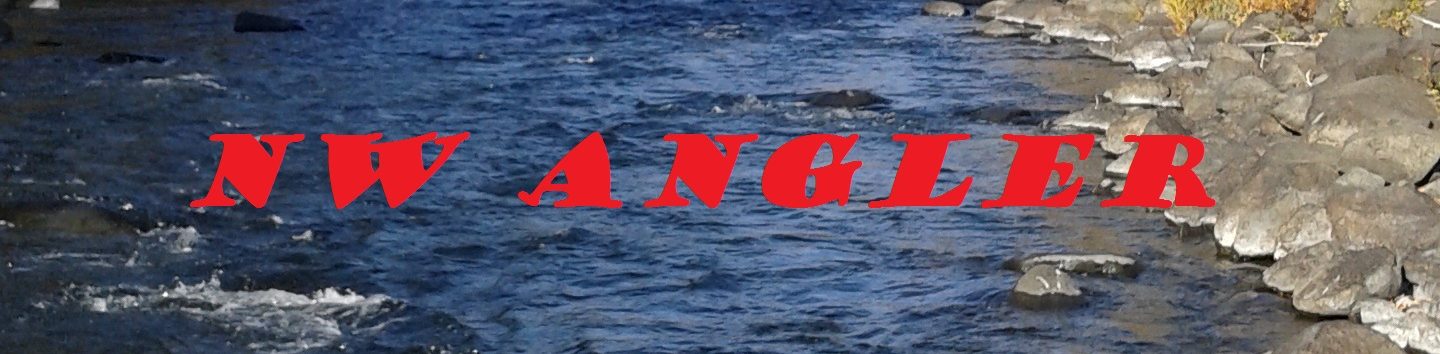
Our destination, today, was Chinook Pass. This link between Western Washington and points to the East is breathtaking, to say the least.
This is the origin of the American River, which leads down to and through so many of the fishing spots I haunt that I feel like this place is owed my respect.
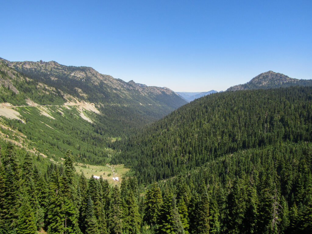
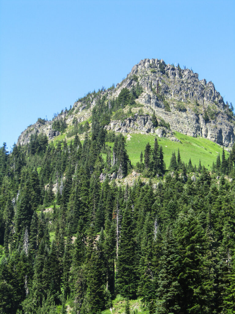
Around the bend from that, you come face-to-face with the looming giant of this area.
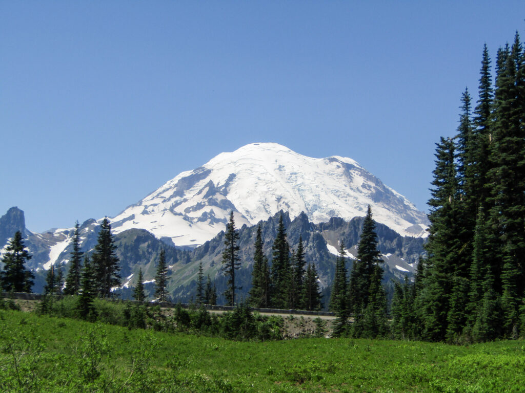
In the midst of this, there are places to pull off, park, and hit trails. Quite busy, on a Saturday in July, but we found a spot and headed out for at least a loop around the small “lake” (okay, pond, really) that rests just West of the pass itself.
Fed by runoff and appearing to be only a few feet deep, this body of water makes, if nothing else, for a great reflecting pool.
Walking in this area offers spectacular views of nearby peaks, in addition to Rainier.
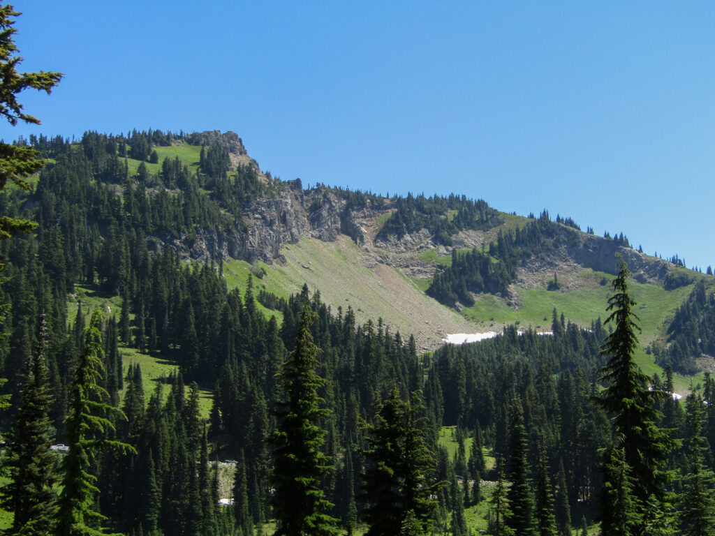
With more time, fewer people, and lower temperatures (even at this elevation, we were seeing high 80’s), there are more challenging local trails to be had. This is also a stop on the Pacific Crest Trail, for those inclined.
We took our time making a circuit of this stop, enjoying the wildflowers and scenery, then decided we wanted a bit more shade and perhaps smaller (read as: non-existent) crowds. Heading back to the car, I stopped to grab a pic of the road that I knew would take us down the western slopes, had we chosen to head that way.
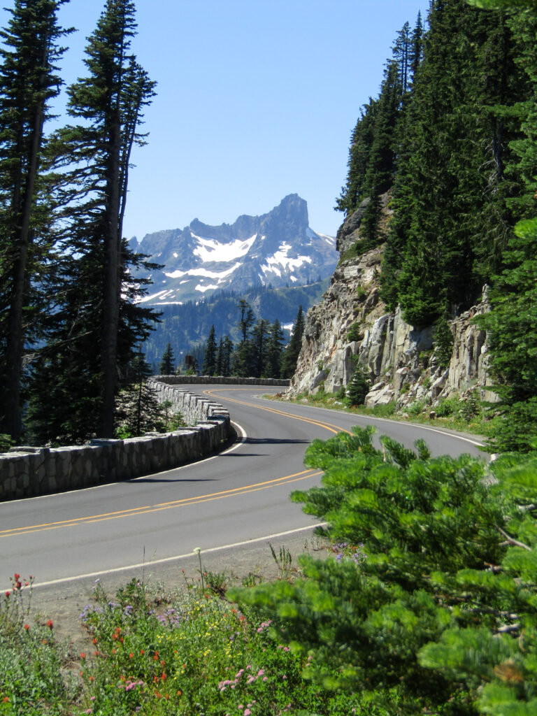
Nice, smooth stretch of road. When I look at a spot like this, I often think to myself “what track of music would I cue up to start just as I hit those curves?”
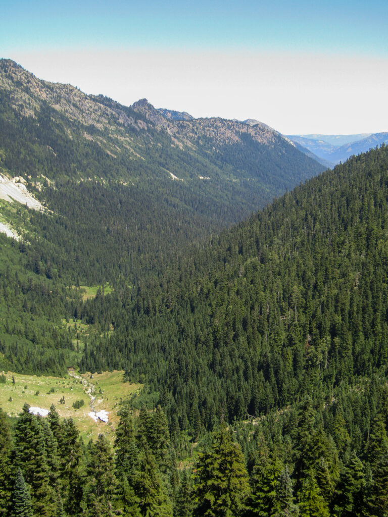
Pulling onto the road, in the other direction, we cleared the pass, stopped for another quick shot of the valley beyond, then headed downhill.
Passing many spots where one could pull off, and dip one’s feet in the cool river, we eventually found the side road leading to a short-loop hike we had taken, years ago.
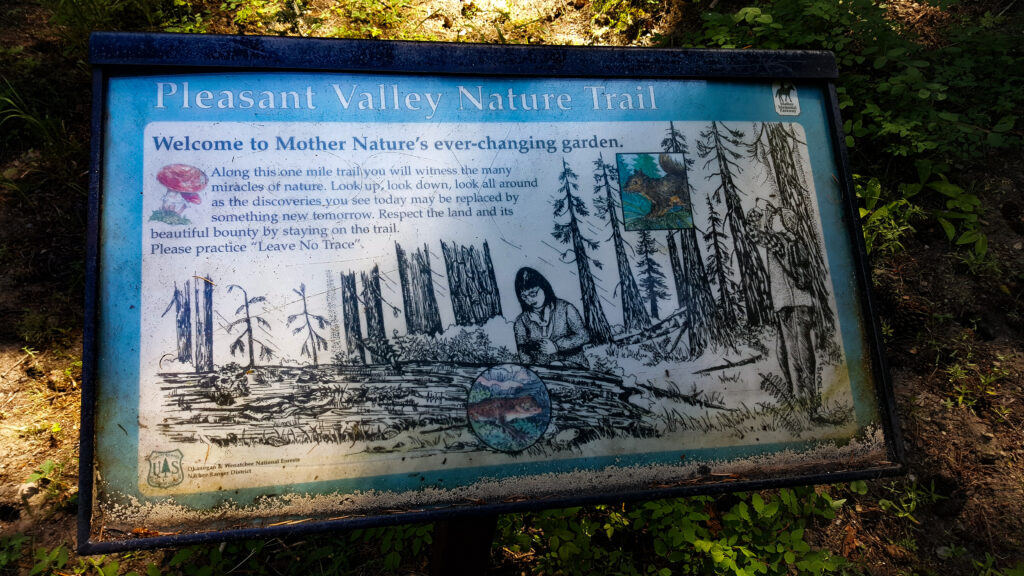
The Pleasant Valley trail is actually paved, although the layer of pine needles and other debris would perhaps not make that obvious. It runs about a mile, but passes through some amazing pine forest. Also of note are the massive ant hills, in several areas. They don’t photograph well, but some mounds are at least 3′ tall.
Great spot for families, and likely good for wagons or wheelchairs, based on the design and path materials.
At one point, the path has a small side area and a bench, set at the top of a steep and sudden slope. Below, the American River runs through.
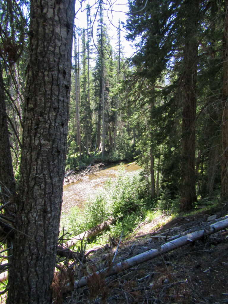
As my wife and daughter rested on the bench, I moved around a bit to get a good view of the water. Just as a comment was made about how the river looked great for fishing, I saw these two move up.
Excellent for fishing, indeed!
I know that there is a 15-mile section of the American that is closed in the middle of the normal fishing season, specifically to protect spawning beds for Chinook and Coho Salmon (I’m 99% sure on the Chinook and 80% on the Coho), but the more I look at this video, the less I think these are Salmon. No vivid colors, etc.
Feel free to let me know what you think, in a reply.
Either way, always a thrill to see such large fish from a distance. Beautiful waters and amazing area.
Tomorrow, I may hit the last couple hours of daylight on a river. We shall see. Regardless, today was a great little getaway.
Tight lines…